Drone Mapping


We Fly... We Produce... We Deliver...

Drone Mapping 2D Orthomosaic and 3D Photogrammetry


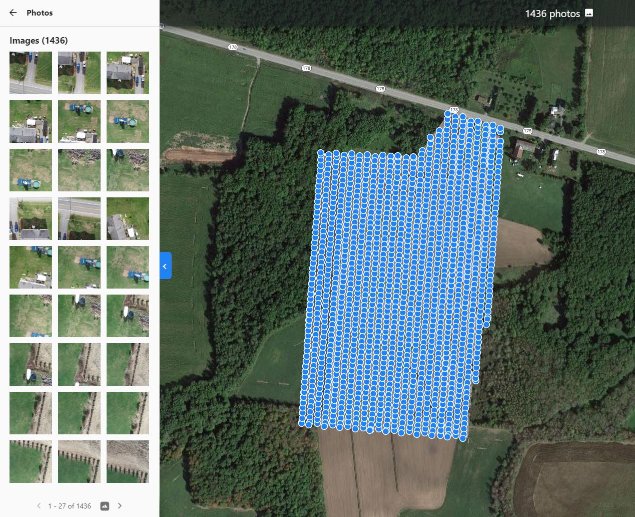
Drone mapping is the process of using drones (unmanned aerial vehicles, or UAVs) equipped with cameras or sensors to capture aerial data that is then processed into maps, 3D models, or measurements of the Earth’s surface or structures.

How Drone Mapping Works:

  • Flight Planning: A mapping drone flies a predefined path over the area of interest, capturing overlapping images at regular intervals. The drone’s camera or sensor (RGB, multispectral, LiDAR, or Thermal) takes hundreds or thousands of photos.

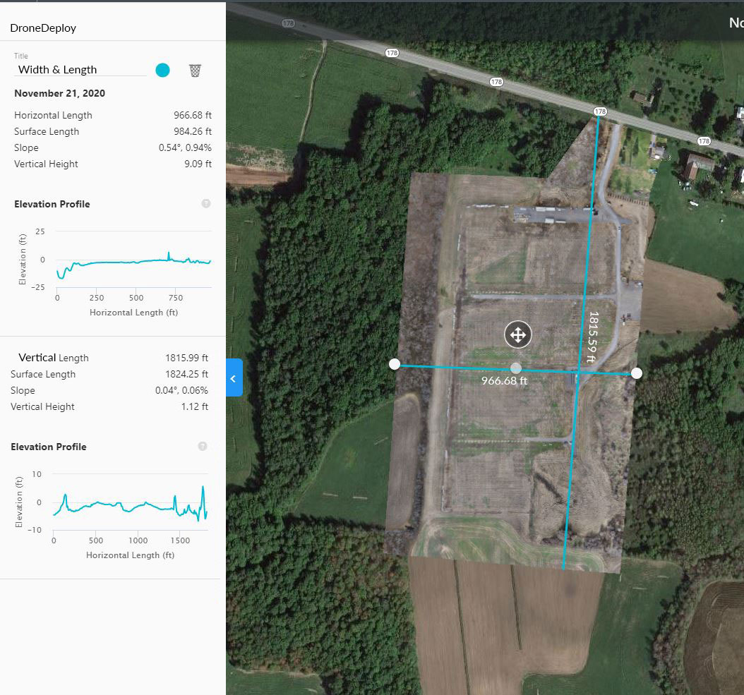
Click for full image

  • RTK Drone Mapping stands for Real-Time Kinematic Drone Mapping — aAn RTK Mobile Station System (often called an RTK Base Station or RTK Rover System, depending on its role) is part of a Real-Time Kinematic (RTK) positioning setup used to achieve centimeter-level GPS accuracy — far more precise than standard GPS.

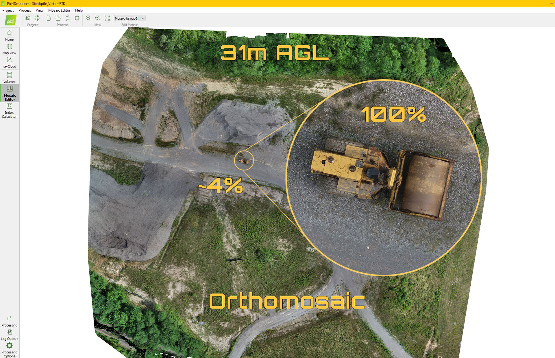
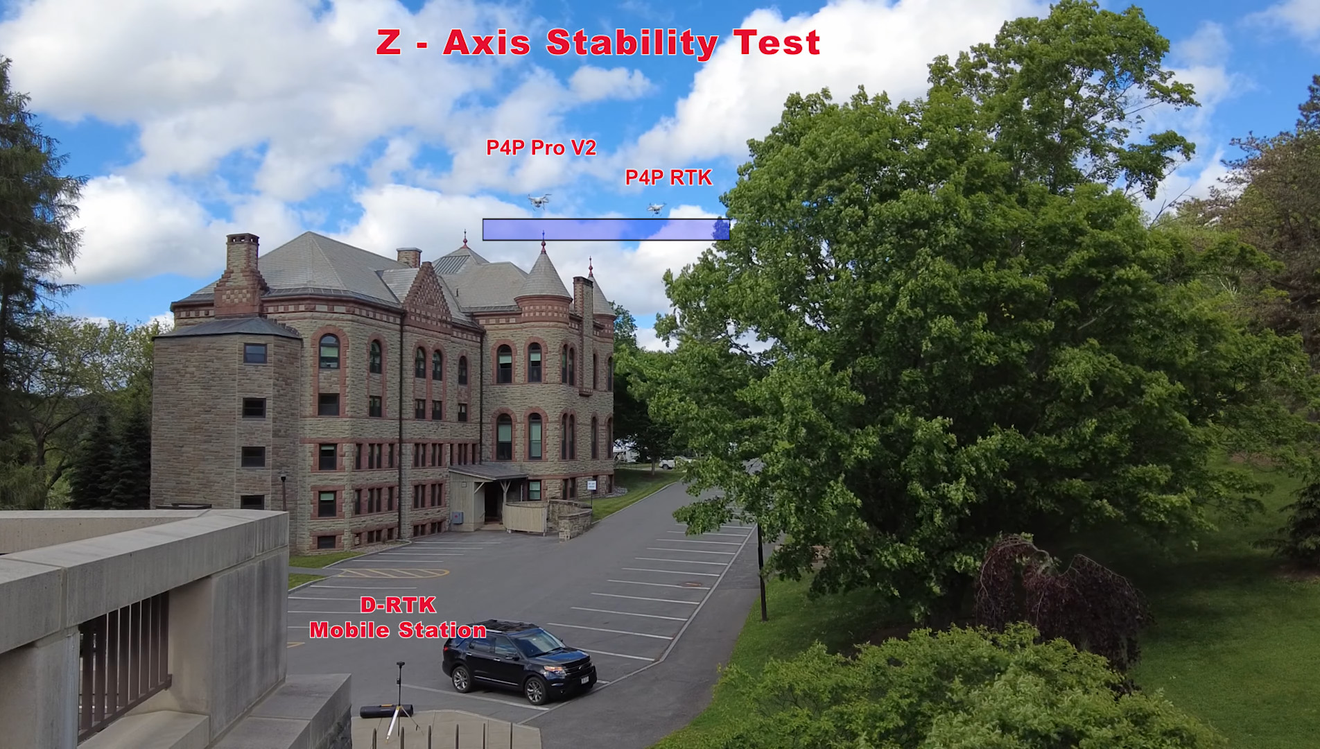
Watch this video to see the actual benefits of RTK

  • Post Production/Data Processing
    • Orthomosaic map: A georeferenced, high-resolution map
    • 3D Point Clouds/ mesh: A digital reconstruction of terrain or buildings for percise measurements and volumetrics
    • Digital Terrain/Digital Surface Models: Height or elevation maps
    • Contour maps: Used for engineering and planning
    • Volumetric analysis: Calculate stockpile or excavation volumes

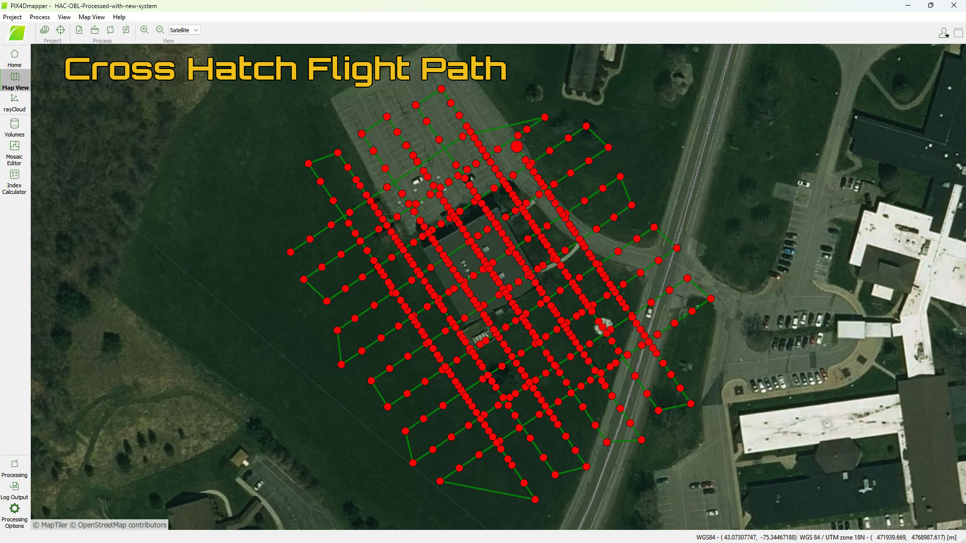
Click for full size image

Contact Drone-Scapes now